The Big Lakes & Rivers
The Big Lakes & Rivers
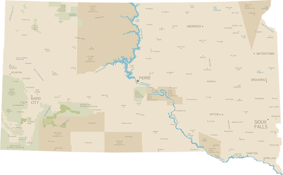
Central South Dakota is home to a huge stretch of the Mighty Missouri River, 443 miles of big water running from the top of the state to the bottom edge border with Nebraska, practically cutting South Dakota in half. The river itself is divided into four lake-like reservoirs, created by large hydroelectric dams built between 1940s-1960s. These dams expanded the once-narrow Missouri River, flooding thousands of acres of valley land to create expansive lakes, useful for irrigation, flood control, electricity, and recreation. River towns and campsites, private and public, are the best places to stay when exploring the river.
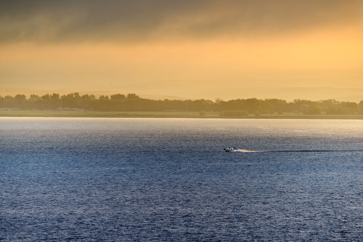
The Mighty Mo is a significant part of life in Central SoDak. It lies along major bird migratory routes; all kinds of geese, ducks, and other migratory birds can be seen in the skies or on the water. The river attracts and provides habitat for a menagerie of wildlife, from beavers and foxes to deer and upland birds like pheasants and grouse. In the waters live fresh-water fish: walleye, bass, trout, catfish, perch, salmon, pike, and the peculiar paddlefish.
 Lake Oahe
Lake Oahe
The northernmost and largest reservoir in South Dakota is the vast Lake Oahe, a whopping 231 miles long with more beach acreage than California. The lake spans the distance between South and North Dakota’s capitol cities, from Pierre, SD, to Bismarck, ND. The governors of both states used to visit each other for an annual meeting by boating upriver or downriver, alternating which capitol the meeting took place in each year. Lake Oahe is considered the 5th largest reservoir in the United States. The Cheyenne River and Grande River are two of its major tributaries: all along its massive length are countless bays and off-shoots.
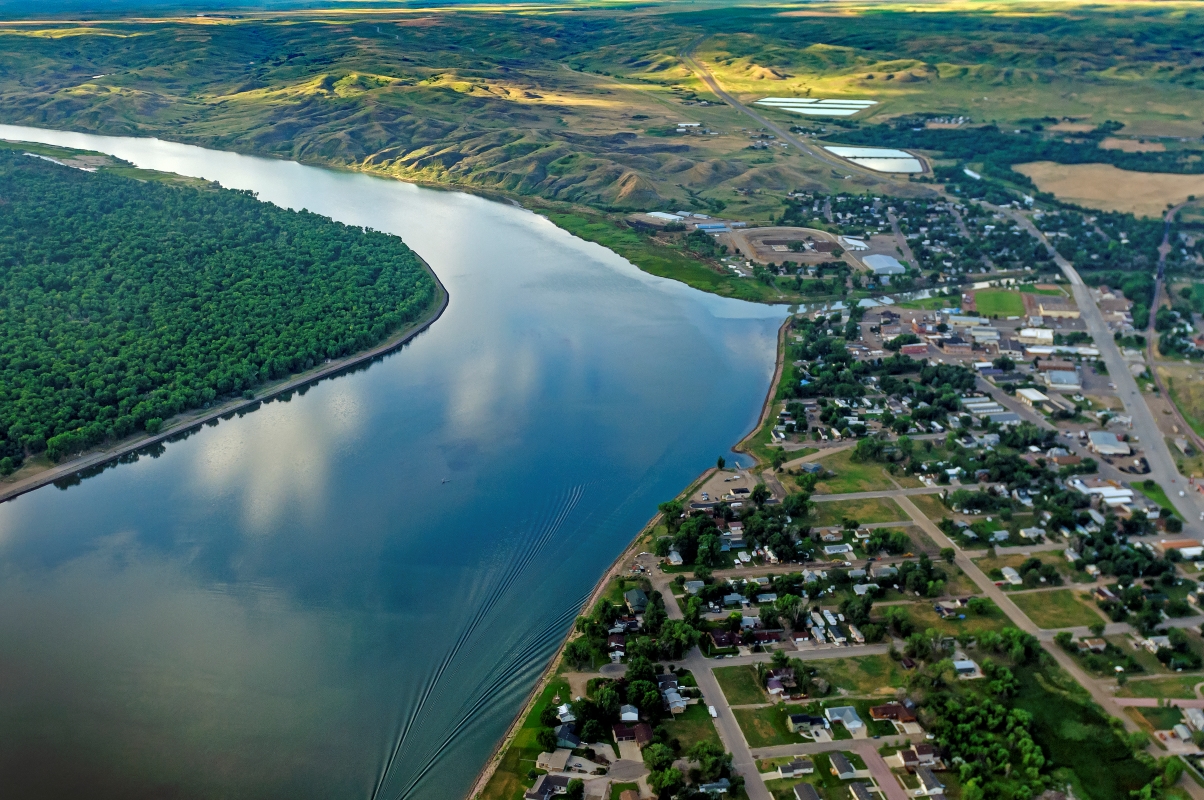
The lake is prime area for fishing and water sports. Having a maximum depth of 205 feet, Lake Oahe is the only reservoir in South Dakota where salmon are able to live year-round. Anglers also enjoy catching walleye, northern pike, perch, bass, and many more species. Ice-fishers gather during winter when Oahe, despite its size, freezes over. Popular river towns along this reservoir are Mobridge, Pollock, Akaska, and Gettysburg.
Being in the middle of the Great Plains, the winds over Lake Oahe can get blustery: pack layers, sunscreen, and plenty of water.
 The Oahe Dam
Oahe Dam
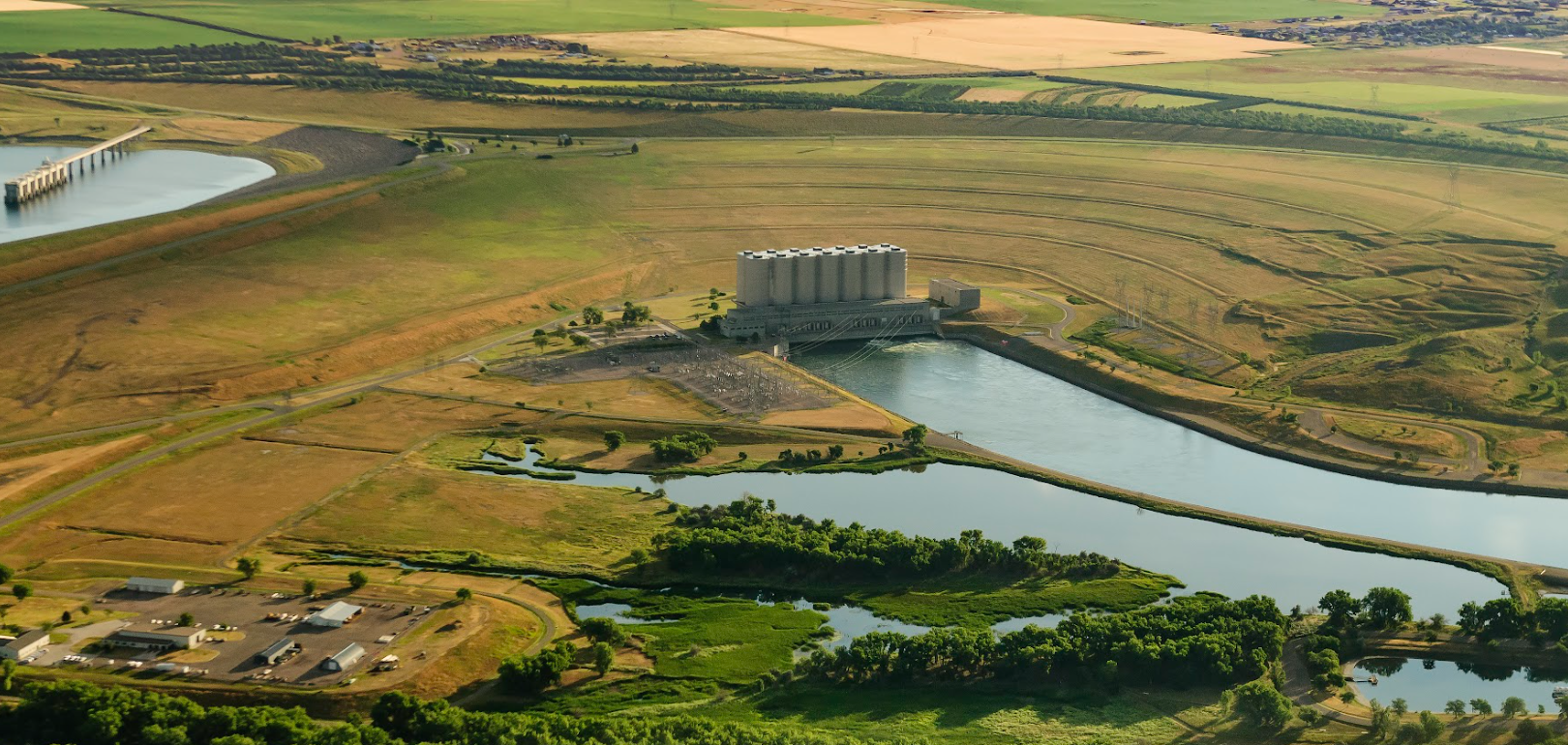
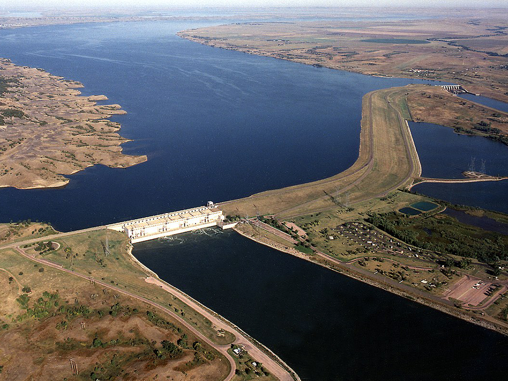
Located six miles north of Pierre and Fort Pierre, the Oahe Dam stands as one of the largest earth-rolled dams anywhere, the largest in the world at the time of its construction. The dam stands 245 feet high and spans 2 miles long across the river, creating Lake Oahe.
The project was authorized in 1944 by the Flood Control Act. The U.S. Army Corps of Engineers began working on the dam in 1948. By 1962, the Oahe Dam was functioning and producing hydroelectric power. Oahe Dam was dedicated on August 17, 1962, by President John F. Kennedy.
The Oahe Dam Visitor Center, located on top of the dam on the east bank, is open year-round, featuring displays and information about the Oahe Dam and the Missouri River. The US Army Corps of Engineers offers free public tours of the Oahe Dam and Powerhouse during the summer: tour season starts on Memorial Day and ends on Labor Day.
 Lake Sharpe
Lake Sharpe
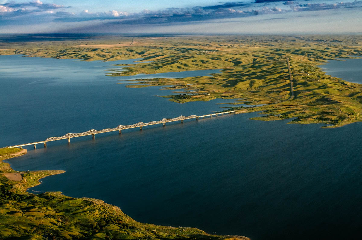
Lake Sharpe lies between Oahe Dam and the Big Bend Dam, 80 miles long and covering over 56,000 acres, with 200 miles of scenic shoreline. Much of the western shore of the lake is within the Lower Brule Indian Reservation, the eastern shore on the Crow Creek Indian Reservation. The lake was named after Merrill Q. Sharpe, the 17th Governor of South Dakota.
The most notable geographical feature of Lake Sharpe is Big Bend, a 25-mile, nearly circular curve the river just north of Fort Thompson, a huge river horse shoe. It can be seen from state recreation area West Bend RA, as well as The Narrows, the thin strip of land lying in the middle of the horse shoe. The Narrows historical interpretive Area is part of Lower Brule Reservation, and requires a permit from the Lower Brule Wildlife Office to access.
The lake is a popular place to fish for walleye, smallmouth bass, bigmouth and smallmouth buffalo, and catfish. The stretch of water between the outlet of the dam and the south edge of Pierre and Fort Pierre are popular places to fish and boat on Lake Sharpe.
Looking for places to stay close to Lake Sharpe? The biggest riverside towns in this area are Pierre, Fort Pierre, and Fort Thompson. Popular campsites on this lake include Oahe Downstream RA and Farm Island RA..
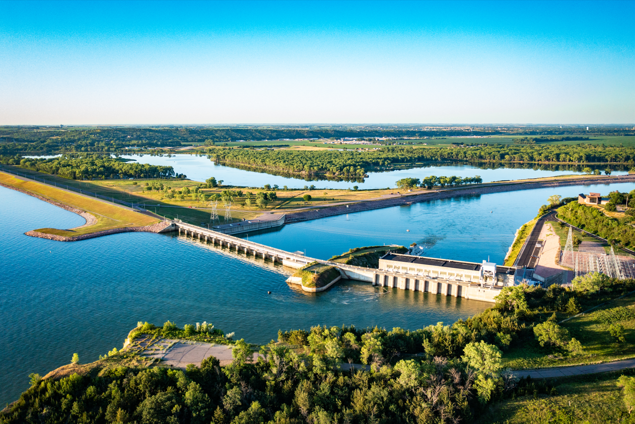
 Big Bend Dam
Big Bend Dam
Another earth-rolled dam constructed as part of the Flood Control Act of 1944, the last to be constructed on the Missouri River in South Dakota in 1963, Big Bend Dam rises 95 feet high and stretches 2 miles across. The dam takes its name from the Big Bend river horse shoe 7 miles upstream
 Lake Francis Case
Lake Francis Case
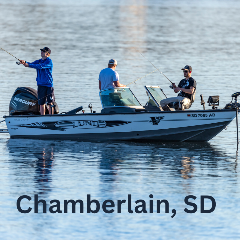
This lake follows a gently undulating diagonal course from the center of the state to the South Dakota-Nebraska border, 107 miles long with a maximum depth of 140 feet. It is narrower than the wide Lake Oahe, but still wider than most rivers that have not been dammed. White River is a major tributary, just south of Chamberlain and Oacoma. Lake Francis Case runs through a rural landscape of rolling hills and prairies, dotted along its banks with campsites, but very few towns. Chamberlain and Oacoma are the two major towns that sit right on this lake. Small rural towns that cater to hunters, anglers, and campers sit close by several miles off the river, including Platte, Kimball, Bonesteel, Geddes, and Lake Andes.
Lake Francis Case is a big hotspot for fishing, and a favorite of anglers from Iowa and Nebraska, being the largest reservoir in the southern part of the state near the states’ borders. Species of fish include walleye, northern pike, sauger, sunfish, yellow perch, common carp, black bullhead, channel catfish and smallmouth bass.
Just off of Lake Francis Case at the southern end is Lake Andes, a smaller lake home to several waterfowl production areas and a national wildlife refuge established by President Franklin Roosevelt. Lake Andes is accompanied by its own town of the same name. During the spring and fall migrations, bird watchers can enjoy a diversity of birds, including a large number of bald and golden eagles.
 Fort Randall Dam
Fort Randall Dam
Part of the Flood Control Act of 1944, this dam was completed in 1954. President Dwight D. Eisenhower threw the switch that started the first power generating unit.
Pickstown, a town still existent today, was built solely for the purpose of housing the workers needed to build the dam. The town sits right next to the dam on the east bank. Large campsites in the state recreation areas north and south of the dam provide great spots for anglers and boaters to stay and enjoy Lake Frances Case.
The Fort Randall Dam area is home to one of America's largest wintering concentrations of bald and golden eagles. The Karl E. Mundt National Wildlife Refuge, just below Fort Randall Dam, is where visitors often spot bald eagles sitting high atop cottonwood trees lining the shore. Winter is prime eagle-watching time.
Fort Randall Dam was built on the site of old Fort Randall, a military fort built in 1856, consisting of a chapel, outpost, and cemetery. The historic sites are maintained and are open year-round.
 Lewis and Clark Lake
Lewis and Clark Lake
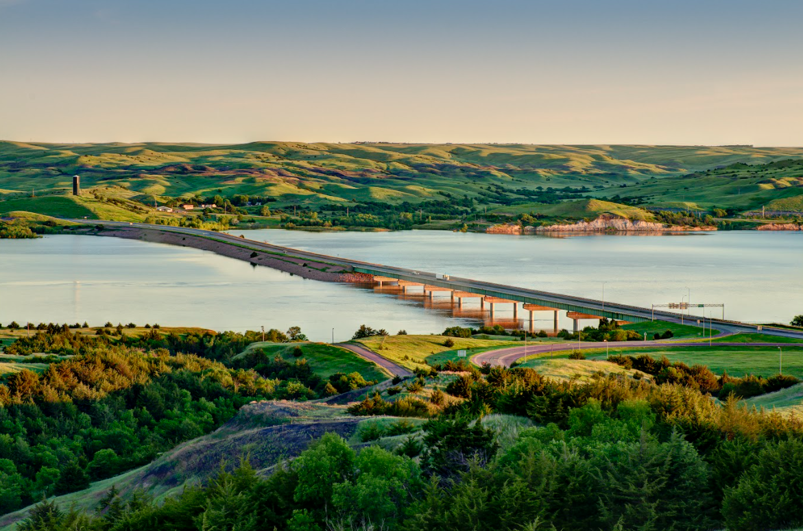
The smallest of the four reservoirs, Lewis & Clark Lake is a charming body of water that attracts over two million visitors per year. Situated on the border of South Dakota and Nebraska, the area boasts beautiful chalky bluffs along the shore near Gavins Point Dam in Yankton. The twenty-five mile long lake holds a special attraction for sailing enthusiasts; brightly colored sails dot the water all summer long.
Outdoor recreation, camping, fishing and hunting are popular attractions in and around the Lewis & Clark Lake area. It was in this area, at Calumet Bluff, that Lewis and Clark had their first meeting with the Yankton Sioux in 1804. On either end of Lewis & Clark Lake sit two natural segments of Missouri River that flow unrestricted. These narrow, winding waters more closely resemble what Lewis and Clark would have seen as they came up the Missouri in 1804.
 Gavins Point Dam
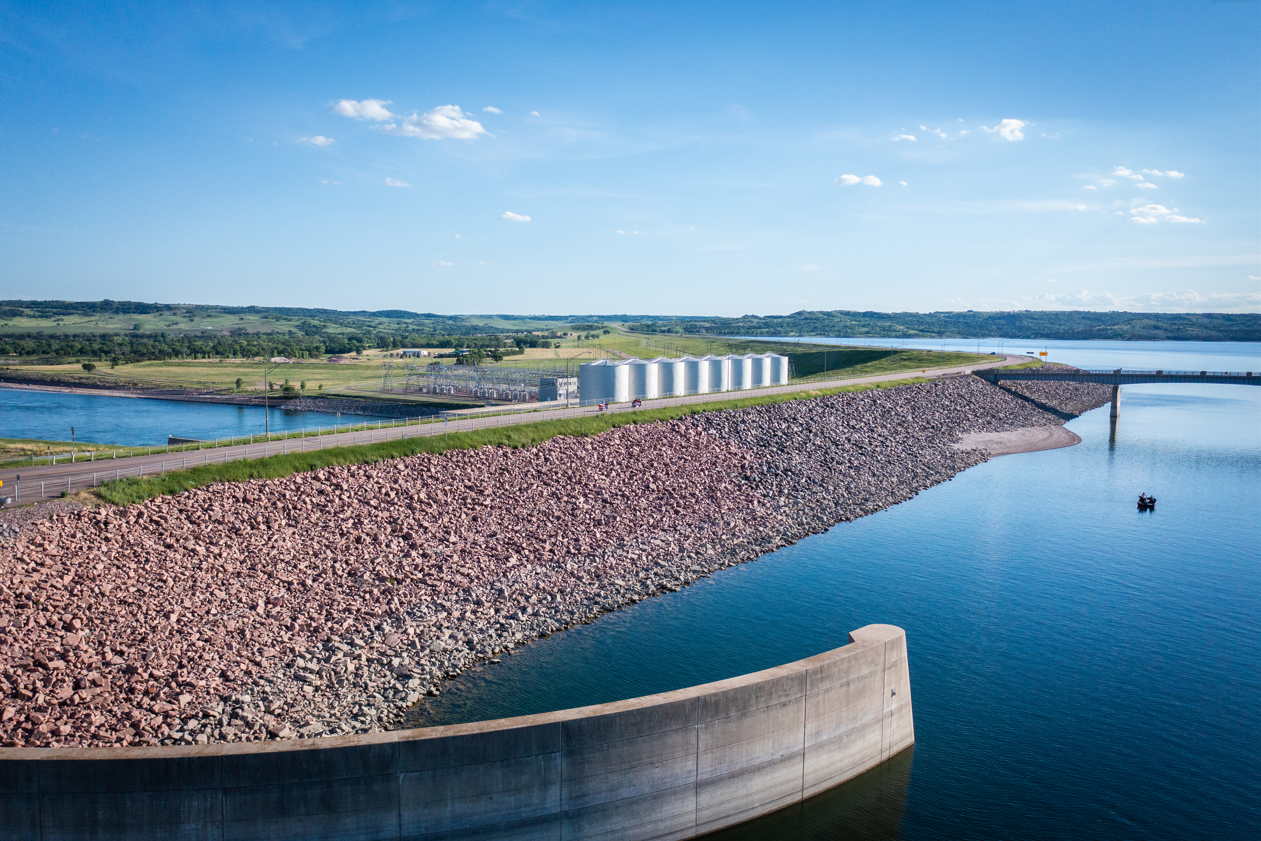
Gavins Point Dam
Located four miles west of Yankton, ground was broken at the dam site on May 18, 1952, in a ceremony attended by Lieutenant General Lewis Pick, then Chief of Engineers, and the Governors of South Dakota and Nebraska.
Tree-lined public camping areas surround the lake above and below Gavins Point Dam. Camping facilities provided by the Corps and the States of South Dakota and Nebraska include campsites with electricity, modern restrooms, playground equipment and trailer dump stations.
The Lewis and Clark Center is located on top of Calumet Bluff just downstream from the Gavins Point Power plant. The Lewis & Clark Visitor Center provides a spectacular view of Lewis & Clark Lake, Gavins Point Dam, and the Missouri River. The visitor center is open Memorial Day to Labor Day with off-season hours September through October.


Education
April 26, 2024 - April 29, 2024
When 12:00am - 11:00pm
Where Hughes, Jones, Lyman, Stanley, and Sully Counties

Fishing
April 26, 2024 - April 28, 2024
When 6:00am - 6:00pm


21+
April 27, 2024
When 3:30pm - 6:30pm

Fishing
May 4, 2024
When 5:00am - 6:00pm

Outdoors
May 25, 2024 - May 26, 2024
When 9:00am - 6:00pm
Where Pierre Regional Airport

History
June 7, 2024
When 12:00pm - 1:00pm